After a 163-day journey of over 60,000 nautical miles (more than 110,000 kilometers), China's 39th scientific expedition to Antarctica concluded as the mission members returned to their home port in Shanghai on April 6th. Two students from Tongji University were among the first group of returnees on April 4th. They were GU Yuanyuan, a doctoral student and CAO Zheyi, a master's student, both of the year 2021 from the College of Surveying and Geo-informatics.
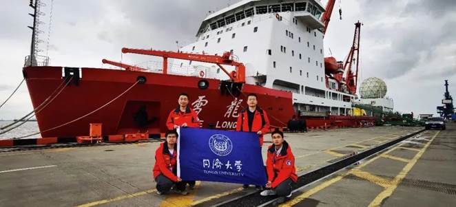
The expedition team left Shanghai in late October 2022. GU and CAO joined an inland team at Zhongshan Station after they reached Antarctica. They arrived at China's Antarctic Kunlun Station following a short stay at Taishan Station with support from Tongji University, the Poler Center, and the entire team.
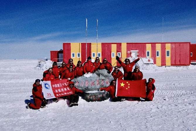
The inland team at China's Kunlun Station in Antarctica
(GU Yuanyuan fourth and CAO Zheyi fifth from left in the back row)
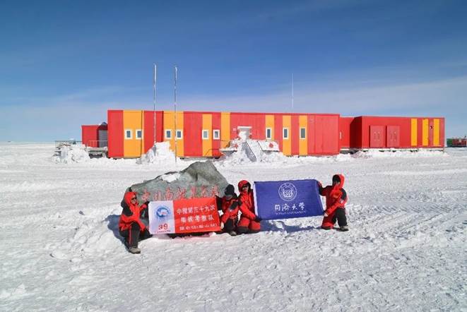
GU Yuanyuan and CAO Zheyi holding the red flag of the 39th expedition at Kunlun Station.
They completed research tasks along the way by collecting data and providing data support for accurately measuring the contribution of the Antarctic ice sheet mass balance to ocean level rise.
During this expedition, they conducted research on key parameters including ice flow velocity, ice mass loss, and subglacial/sub-snow temperature related to the material balance of glaciers and ice caps as well as global ocean level change along and around the Zhongshan, Taishan, and Kunlun stations. Their main job responsibilities included segmented long-distance vehicle-mounted GNSS measurement at stations along the inland expedition route; ground-based high-precision verification of single photon altimetry satellite ICESat-2; on-site monitoring of long-term ice flow velocity in Antarctica with satellite corner reflectors.
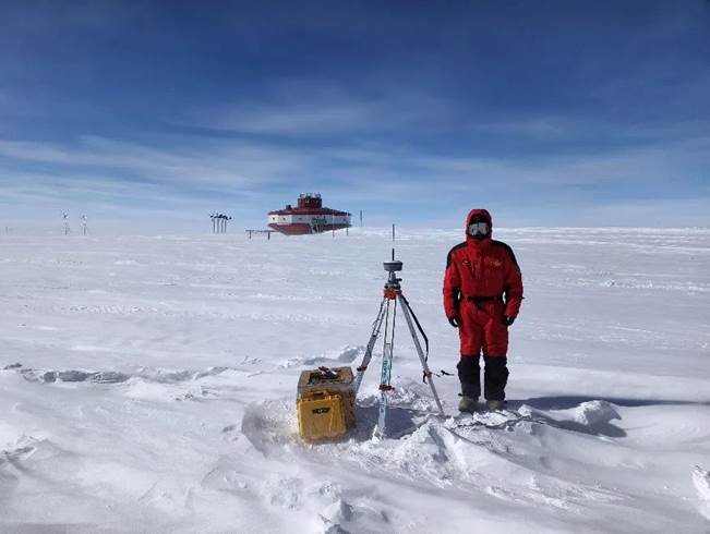
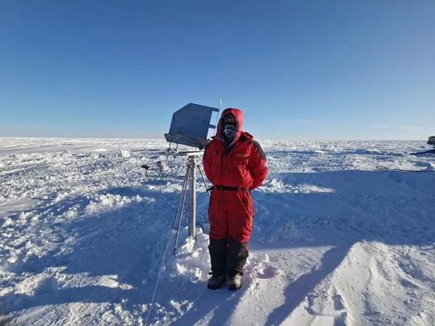
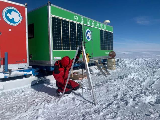
GU sets up a GNSS stand along the expedition route.
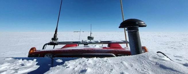
GNSS mobile facility fixed on a vehicle
The inland team carried a lot of equipment which was very heavy. As they traveled further, the temperature turned lower and the air became thinner with the rise of altitudes. Extreme weather such as blizzards could arrive unexpectedly, sometimes with strong winds sweeping up and fine snowflakes forming a white mist in the sky. Team members had to endure the test of 'ground blizzards'.
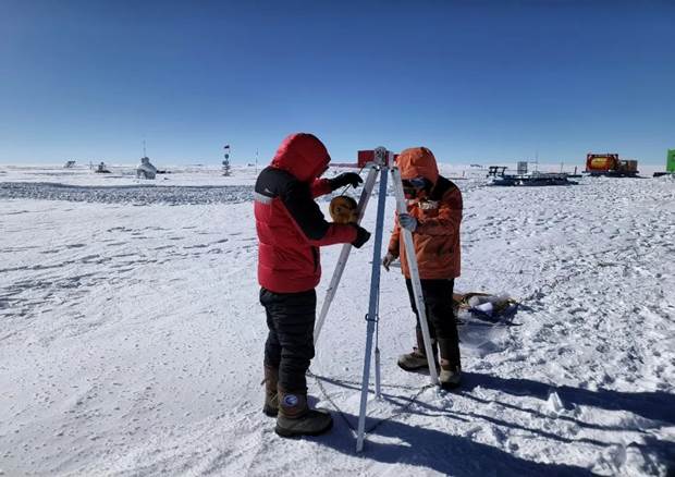
By clearing the snow, adjusting the angle, and repetitive testing, they installed two new sets of SAR satellite corner reflectors and maintained three existing sets, providing ground truth and effective verification data for glacier motion speed obtained from SAR satellite images.
GU Yuanyuan installs corner reflectors along the route.
With the help of the team, GU and CAO installed 20m temperature chains along the way and completed the observation of key parameters (vertical temperature) of material balance and of global ocean level change, which provided verification for the temperature simulation of the snow densification model, and help for long-time observation of the ice temperature change trend. Installing an 80m metal composite chain on the ice cover provides security for verification of China's active and passive microwave technology in polar environments.
GU Yuanyuan (left) and CAO Zheyi (right) operate a 20m hot melt drill at Kunlun Station.
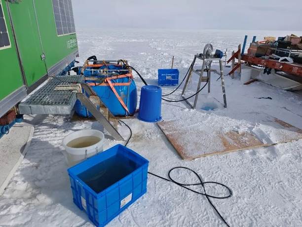
80m hot water drill work site
CAO drills through the ice layer with a hot melt drill
to study the temperature changes in the surface and the ocean
At Kunlun Station and other locations, CAO used unmanned aerial vehicle platforms to detect, analyze, and model micro-terrain on the ice surface, obtaining a large number of UAV DEMs and ice and snow surface coordinate points with centimeter-level accuracy. Typical geographic distribution and geometric properties of ice flow velocity, cracks, ice pits, and other ice features were extracted, and the micro-topography of typical ice sheet surfaces was restored with the support of multi-temporal high-resolution UAV digital products.
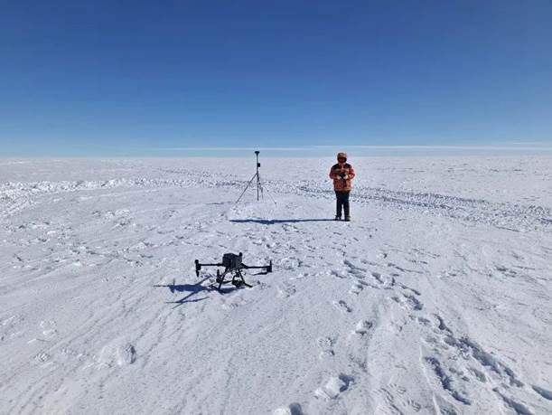
CAO collects drone data at Kunlun Station.
They were often accompanied by complex ice surface and underwater conditions during the expedition. According to CAO, the expedition was guarded with higher safety than their international counterparts owing to the careful preparation and arrangement of the expedition team as well as the sophisticated facilities. The research activities on the way reminded CAO of research at the College of Surveying and Geo-informatics, Tongji University, which was closely related to the precise detection of ice surface and subglacial crevices, and formed an important indicator for evaluating glacier stability. Therefore, he also collected some materials at certain points to prepare first-hand on-site data for subsequent research.
As he walked through and observed the Antarctic continent beneath her feet, GU realized that the Antarctic that she had read about came to life before her very eyes. GU couldn't help exclaim: ‘The scenes I saw there daily were shocking.' Sometimes, one could even see dolphins leaping out of the ocean and penguins flapping their wings, feeling the magical mysteries of nature.
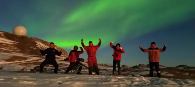
Moments with the aurora
This was also CAO's first time in the southern hemisphere. When the icebreaker Xue Long crossed the equator, he stood on the deck, with the breeze gently brushing his face, and noticed the ocean surface was as calm as a mirror. Looking up, he could see a starry sky that could not be observed in the northern hemisphere. He said, 'It was amazing to have such a wonderful experience. A truly worthwhile trip!'
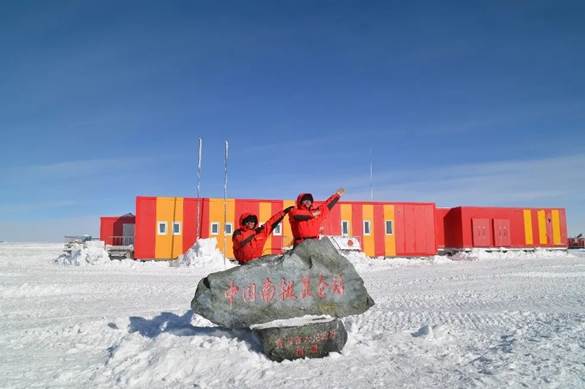
GU Yuanyuan and CAO Zheyi
Tongji University has long been undertaking major research projects on polar science in China. Time and again, groups of Tongji people have taken part in polar expeditions for years, contributing to China's polar scientific research with sustained Tongji Power. The observational data obtained from this expedition will help to build a ground, air, and space-based observation system covering different types of regions, including the polar. It will improve the accuracy of material balance estimation in typical regions of the Southeast Pole, verify key scientific processes in the polar ice zone, analyze key factors in the frozen zone, enhance the ability to estimate key parameters of material balance in the frozen zone and reduce the uncertainty of ocean level change predictions.